Project runs through area known as Griever Canyon
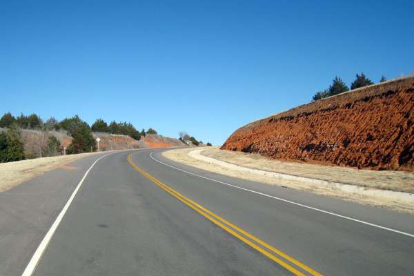
Hills along U.S. Highway 281 in Major County, Okla. added a level of complexity to an Oklahoma Department of Transportation project that replaced an aging bridge. The project runs through an area known to locals as Griever Canyon.
Constructed in the 1930s, the three-span, 100-foot-long bridge across Griever Creek was listed as structurally deficient. The old bridge was also skewed 60 degrees across the creek in an area with steep terrain.
"Just north of the bridge, the replacement project faced grades that exceed six percent," said Garver Project Leader Brent Schniers, PE. "Our preliminary engineering evaluation involved studying multiple alignments for this 1.3-mile bridge and roadway project."
Garver worked with ODOT to determine the best alignment out of seven options with project limits approximately half a mile south and 1 mile north. The selected offset alignment involved replacing the bridge and upgrading most of the corridor to current design standards because portions of the two-lane highway did not meet horizontal and vertical geometry standards. Due to the new alignment's close offset, Garver carefully evaluated the maintenance of traffic to ensure safety measures.
Several major factors influenced the alignment and design—minimizing temporary construction needed to maintain a two-lane facility during the highway construction and working with geotechnical engineers to ensure the stability of proposed design slopes.
Now complete, the bridge over Griever Creek has a 40-foot clear width and utilizes prestressed beams. The extreme angle of Griever Creek to U.S. Highway 281 required the new bridge to be skewed 45 degrees with a 60-foot span and two 90-foot spans. A retaining wall was also utilized at the southeast abutment to prevent fill slopes from impacting the Griever Creek channel.
In addition to replacing the bridge over Griever Creek, a reinforced concrete box (RCB) structure over a tributary to Griever Creek was extended both upstream and downstream. Because of the stream's skew in relation to the roadway alignment and steep surrounding terrain, the downstream RCB extension utilized a broken back configuration to provide proper grading within the clear zone.


Share this article